


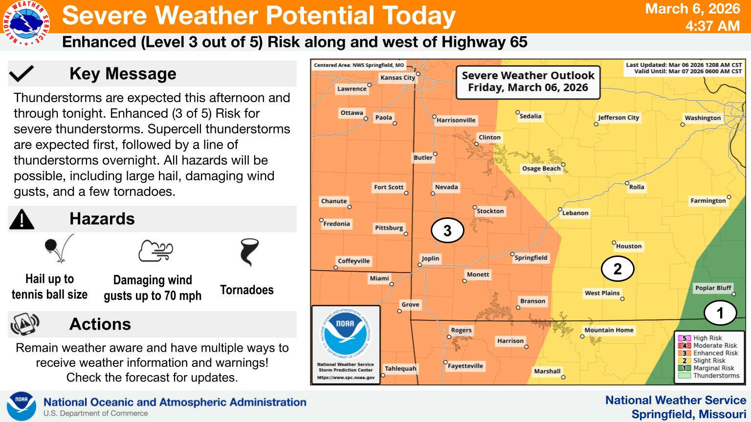
While storms rolled through the region as forecast Friday evening into Saturday morning, most of the strongest storms steered clear of the Lakes Region.
The line of severe weather moved along parallel to Interstate 44. While strong storms moved through the Lakes Region, the only storm warnings issued were Severe Thunderstorm Warnings for Barry and northern Stone Counties and later, a cell redeveloped prompting a warning for parts of Ozark County.
The only area Storm Report submitted so far to the National Weather Service from the Lakes Region was a report of one inch hail in the Cassville area.
The biggest impact in the Lakes Region was heavy rain. Saturday morning, the National Weather Service issued a Flood Warning for Barry and Stone Counties through the day due to the effects of the rain. The Warning is for most of Table Rock Lake and areas around Cape Fair, Jenkins, and McCord Bend. Officials warn motorist to use caution, especially near Low Water Crossings . A previous warming still in effect for other parts of Barry and Stone Counties also includes Christian Counties, where flooding could impact Crane as well as Billings, Clever, Nixa, and Ozark.
Flood Advisories were in effect early this morning for parts of Carroll and Madison Counties in northern Arkansas including areas around Berryville and Green Forest.
Rain is departing the Lakes Region today with highs only in the 50s today before the sun returns and so do 70 degree temperatures on Sunday.


 Fire Officials: Time Change Means Check Smoke Alarm Batteries, Age
 Crane Man Dies in Single Vehicle Crash
 Bowling Fundraiser for Fallen Deputies Enters Day Two
 Active Weather Returns Today, Overnight