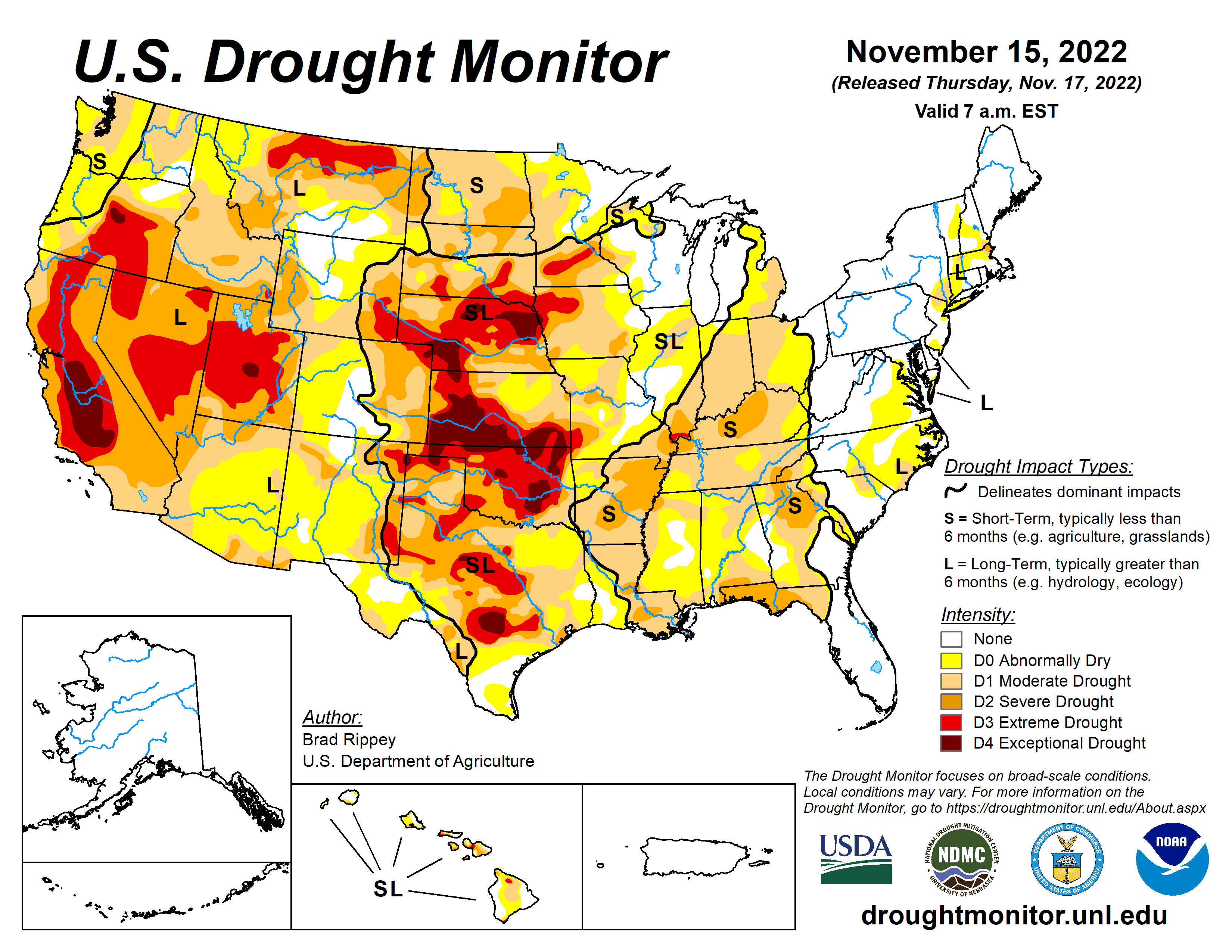
The latest information released from the U.S. Drought Monitor brings good news for many in the Lakes Region.
The latest map released on Thursday shows the lowest levels around the region since rainfall began to tapper off in June.
Currently, most of the Missouri Lakes Region including Barry, Stone, and Taney Counties are at an Abnormally Dry Level. The northern two-thirds of Ozark County is at the same level while the remainder of Ozark County including areas around Bull Shoals and Norfork Lakes remain at a Moderate Drought Level.
Boarder areas between Arkansas and Missouri in northern Boone, Carroll, and Marion Counties are also Abnormally Dry while the rest of the region is at a Moderate Level.
Continuing rainfall has led to a steady downward trend in the Drought Levels over the past few weeks, though many area waterways are still at below normal levels.


 Branson Public Schools Offers Free Summer Meal Program
 Area Counties Benefit from U.S. Forest Service Grants
 White River Marine Group Sees Layoffs at Three Plants, One in Lakes Region


