After a windy but otherwise calm day today, weather will begin to change quickly over the following 24 hours.
Update 2:
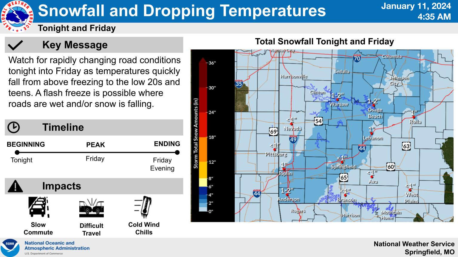
A Winter Weather Advisory goes into effect for southwest Missouri including the Branson/Lakes Region from 4:00 am to 12:00 pm Friday. A similar advisory is in effect for northwest Arkansas Friday morning. The National Weather Service says up to an inch of snow may fall during that time with roadways wet from the rain ahead of the front possible experiencing a flash freeze due to the rapidly dropping temperatures during the morning. Wind Advisories are also in effect for the entire region Friday afternoon and evening with potential wind gusts of 45-50 MPH possible.
Update:
Click below for interview with Kyle Perez, Meteorologist with the National Weather Service Office in Springfield from KRZK's "Ozarks Now" program on the timing and type of weather for the next few days.
Original Story:
Weather forecasters predict the Lakes Region to begin receiving rain and thunderstorms this evening with a marginal risk that these storms could become severe with strong winds and small hail.
The cold front will arrive in the Ozarks around sunrise Friday morning when temperatures begin to fall rapidly, dropping into the low 20’s before Noon with the rain transitioning to snow by mid-morning. Although current forecasts call for accumulations to be around one inch, wind gusts of up to 40 MPH could make driving conditions hazardous.
There will be a break in the precipitation on Saturday, but snow showers will be back in the forecast for Sunday as temperatures continue to drop with highs only in the teens and lows around zero. Wind chill readings from Sunday through Tuesday are forecast to be well below zero.
While snow will end after Sunday, high temperatures are not forecast to be above freezing again until Wednesday.
 August Begins Below Normal Temperatures
 Ozarks Tech Hosts Open Houses on Area Campuses
 Drought Levels Stay Steady in the Ozarks
 Update on Ribbon Cutting for Re-Opening of Downtown Harrison Bridge
 CHANGES at HUMANE SOCIETY


