
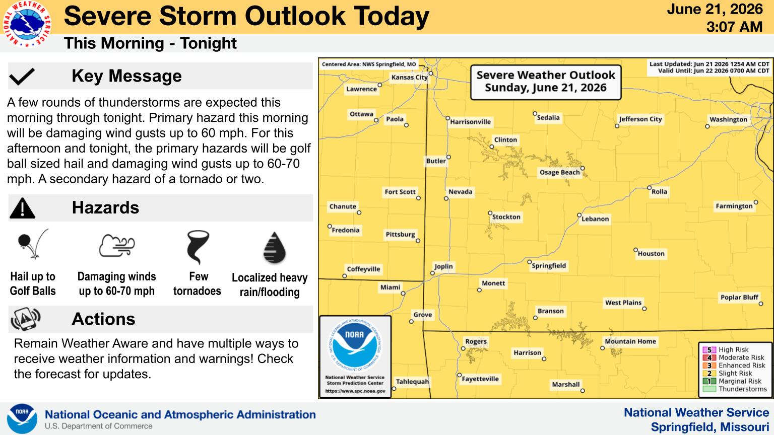
As Spring turned into Summer over the weekend, the Ozarks remained in a springlike pattern with rounds of showers and thunderstorms hitting the region.
Sunday morning saw severe thunderstorms lead to Tornado Warnings in the Springfield area. The only storm reports submitted to the National Weather Service to this point is for some trees knocked down after the storms had passed with winds that gusted to 30 MPH. The storms did lead to power outages around Springfield which led to some church services being shortened and some businesses delaying their Sunday openings according to information received by Ozarks Dynacom News.
The second wave of rain that made it all the way to the Lakes Region has produced heavy rain. Flash Flood Warnings have been issued until 8:00 this morning for the southern parts of Barry, Stone, Taney, and Ozark Counties as well as northern Marion County in Arkansas. According to NWS Statements, between 1 and 2 inches of rain have fallen with additional rainfall amounts of 1 to 3 inches possible in the warned area. The heavy rain could lead to Flash flooding of small creeks and streams, urban areas, highways, streets and underpasses as well as other poor drainage and low-lying areas.
The rain is expected to end later this morning and be replaced with cooler temperatures in the upper 70s to low 80s over the next two days.
 Branson Police Department Brings Back Motorcycle Unit
 Multiple Agencies Respond to Juvenile Trapped in Water
 H2Ozarks Among Groups Benefitting from Latest Grants from Arkansas Department of Agriculture
 Flood Watch in Effect, Heavy Rain and Storms Possible UPDATE


