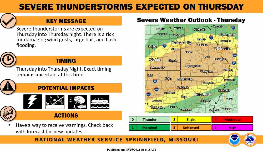
Much of Northwest Arkansas and Southwest Missouri could see a round of Severe Weather on Thursday.
Forecasters for the National Weather Service say that Thunderstorm development will build on Thursday afternoon into the evening with Damaging Winds, Large Hail, and Flash Flooding the biggest risks.
Much of the region will see a break in the rain today with just chances of scattered showers before Thursday’s Severe Potential. Forecasters say much of the upcoming Memorial Day Weekend will be dry with a chance of some showers redeveloping on Monday.
 August Begins Below Normal Temperatures
 Ozarks Tech Hosts Open Houses on Area Campuses
 Drought Levels Stay Steady in the Ozarks
 Update on Ribbon Cutting for Re-Opening of Downtown Harrison Bridge
 CHANGES at HUMANE SOCIETY


