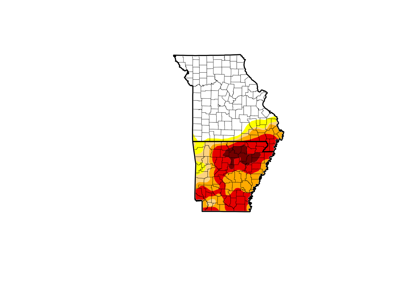
While the Tuesday rains were much needed in the Lakes Region, the showers had little impact on this week's report from the U.S. Drought Monitor.
Mark Burchfield from the National Weather Service explained on a recent interview on KRZK's "Ozarks Now" program that U.S. Drought Monitor puts together the final map during the day on Tuesday before releasing it on Thursday. Since showers were ongoing that day, not all the rainfall will be accounted for in this week's report.
The rain earlier in the week impacted Missouri more, causing most the area to now be drought free. Only areas south of a Shell Knob-Kimberling City-Branson line are at an Abnormally Dry Level.
In northern Arkansas, the most significant rain came on Tuesday which for this report, still leaves that part of the Lakes Region at a Severe to Exceptional Drought Level. Much of the area southeast of Harrison is at an Extreme Drought Level with parts of Marion and Searcy Counties remaining at the Exceptional Level.
More rain is in the forecast for the Lakes Region Monday night into Tuesday.
 August Begins Below Normal Temperatures
 Ozarks Tech Hosts Open Houses on Area Campuses
 Drought Levels Stay Steady in the Ozarks
 Update on Ribbon Cutting for Re-Opening of Downtown Harrison Bridge
 CHANGES at HUMANE SOCIETY


