While most of today will be dry, rain begins to move back into the area pushing the Lakes Region back into a rain pattern for the rest of the week.
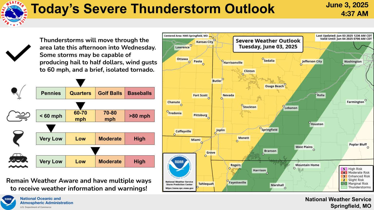
Justin Titus with the National Weather Service in Springfield says during an interview on KRZK’s “Ozarks Now” program that a frontal boundary will move into the region then stall over the Ozarks for several days.
Forecast models indicate the heaviest rain will be northwest of the Lakes Region but scattered showers with a Marginal Risk of Severe Thunderstorms will be possible late in the day and this evening.
 August Begins Below Normal Temperatures
 Ozarks Tech Hosts Open Houses on Area Campuses
 Drought Levels Stay Steady in the Ozarks
 Update on Ribbon Cutting for Re-Opening of Downtown Harrison Bridge
 CHANGES at HUMANE SOCIETY


