Record wind chills are expected to roll into the region on Thursday and persist into the Christmas Weekend.
UPDATE
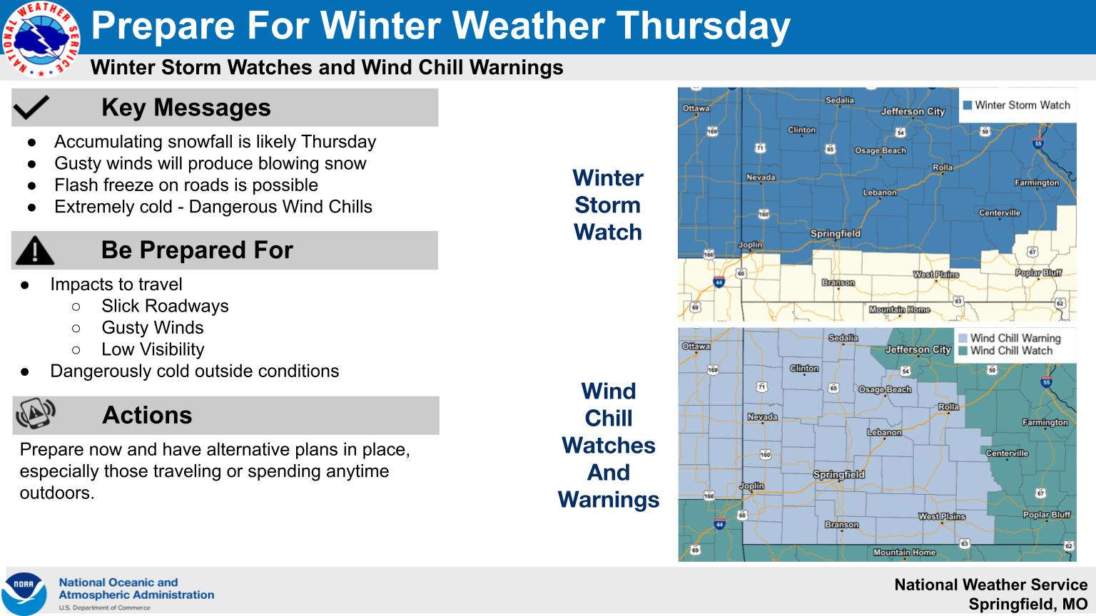
The National Weather Service has now issued a Wind Chill Warning for all of the Lakes Region. The Advisory runs from Thursday to Noon on Saturday in Missouri and from Thursday through Friday morning in Arkansas. Some areas could see 30 below zero wind chills during this period. Also, a Winter Weather Advisory is in effect for Thursday with an inch or two of snow possible with the passage of the front.
Justin Titus of the National Weather Service Office in Springfield talks about the incoming front during an interview on KRZK's "Ozarks Now" program. Titus says that temperatures will actually begin in the 30's Thursday morning but will fall quickly during the day to near the single digits by the end of the afternoon. Strong winds will send wind chills to 20 below by the end of the day and stay there through Friday with daytime highs Friday only around 10 above. A Wind Chill Watch is in effect from late Wednesday night through Saturday morning in southern Missouri and Thursday and Friday for northern Arkansas.
Titus says that driving conditions Thursday will also be impacted by snow fall which could make visibilities very low and some roads slick. The current track of the storm still has the heaviest snow north of the Lakes Region but that could also change over the next 24 hours.
Titus also says that while there is going to be snowfall in the area, the chances of that snow lingering until Christmas Day is low, though some snow could still be on the ground in areas where heavier amounts fall.
The complete interview with Justin Titus can be heard below:
 Drought Levels Stay Steady in the Ozarks
 Update on Ribbon Cutting for Re-Opening of Downtown Harrison Bridge
 CHANGES at HUMANE SOCIETY
 LAST DAY TO LAUNCH INTO LEARNING
 FBC BRANSON BACK TO SCHOOL BASH


