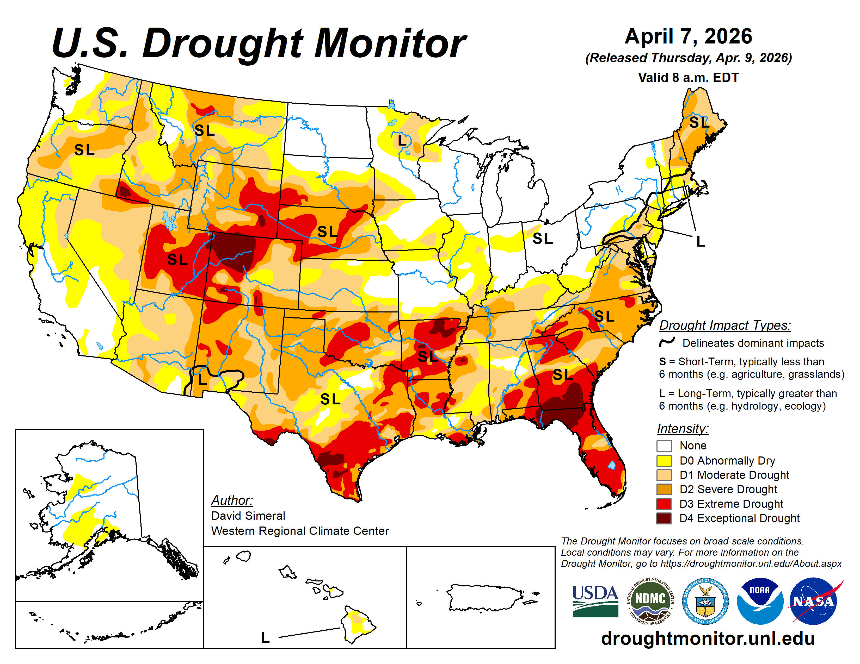
The Arkansas-Missouri Border is also the line between higher and lower levels of drought in the Lakes Region.
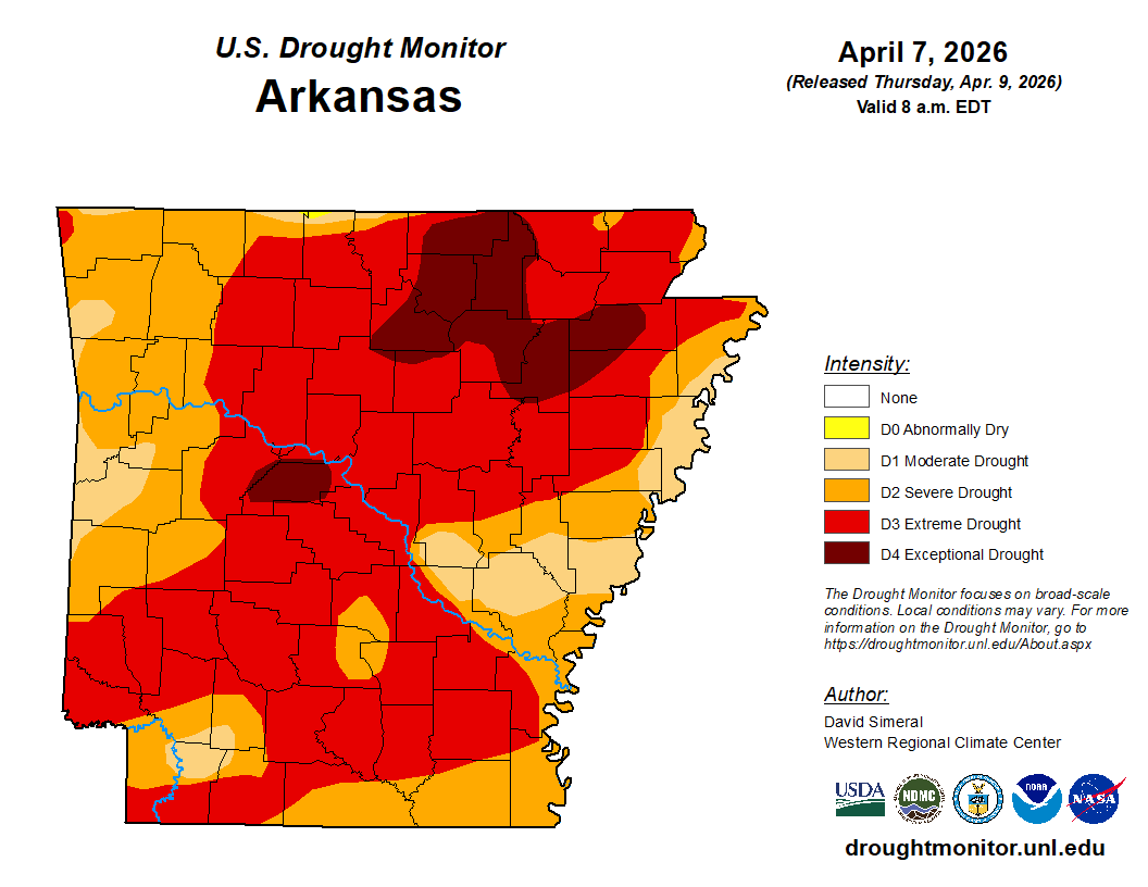
The latest map from the U.S. Drought Monitor shows Arkansas Drought Levels still on the rise. Though the recent rainfall helped water levels at places like the Buffalo National River, the rain did little else to slow drought impacts with northern Arkansas remaining at a Severe to Extreme level. Conditions are even worse just outside the Lakes Region as areas southeast of Mountain Home are at an Exceptional Level, the highest on the Drought Monitor Scale.
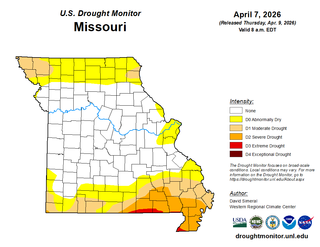
Meanwhile, Missouri overall saw a huge drop in drought levels as the heavy rain that parked over central Missouri eliminated drought conditions. The Lakes Region did not get as much benefit, but the rainfall did hold drought levels steady in the Branson region at Moderate to Abnormally Dry.
More rain is expected in the Lakes Region over the next five days which could impact drought conditions.


 Music on the Square Returns to Downtown Harrison
 SDC Foundation Partnering with Care to Learn for Lakes Region Expansion
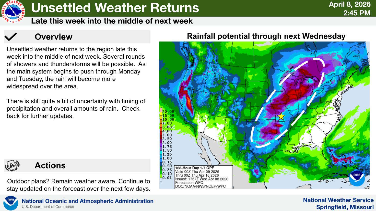 Unsettled Weather Pattern Returning to the Lakes Region
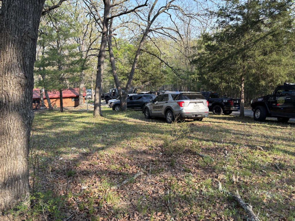 Men Arrested After Standoff in Stone County